El Niño looms but we're still a long way from drought
14 July 2023
The World Meteorological Organisation (WMO) recently confirmed that El Niño conditions are underway and likely to continue in the second half of the year, peaking in the Southern Hemisphere summer.
While El Niño events generally increase the risks of heatwaves, droughts and bushfires, it is too early to say that Australia should brace for a long hot and dry summer that will lead to a drought, a Federation researcher says.
The WMO says El Niño conditions have developed in the tropical Pacific for the first time in seven years, and this will likely see a surge in global temperatures and disruptive weather and climate patterns.
The Bureau of Meteorology's (BoM) ENSO Outlook, an alert system for the El Niño–Southern Oscillation, is at El Niño Alert level – meaning the chance of an El Niño developing in the coming season has increased. ENSO is the oscillation between El Niño and La Niña conditions. The BoM says when specific criteria to reach El Niño Alert level have been met in the past, an El Niño event has developed about 70 per cent of the time.
El Niño is a weather pattern characterised by hotter temperatures and reduced rainfall in east and northern Australia, while La Niña often leads to more rainfall and cooler temperature across most of the country, as noted over the last three years.
Federation climate scientist Associate Professor Savin Chand says climatic conditions typically swing between El Niño, La Niña and neutral conditions, with El Niño occurring every three to seven years, but Australia has a unique set of characteristics that can contribute to the weather extremes that often prevail.
"We have a phenomenon called the trade winds that blow from the east to west in the earth's equatorial region, sustaining warmer water more in the Western Pacific than in the Central and Eastern Pacific," Assoc Prof Chand said.
"During El Niño, these trade winds weaken, and the Central and Eastern Pacific warms up. This change in ocean temperatures sees a shift in rainfall and storminess activities from the Western Pacific to the Central and Eastern Pacific, away from the Australian continent farther towards the dateline."
The result is generally dryer-than-average conditions across the continent – and a stark contrast to the three consecutive years of La Niña that saw strengthening trade winds push the convections back towards Australia, resulting in higher-than-average rainfalls.
"We've seen flooding events over the last three years and cyclones typically become more prevalent during La Niña," Assoc Prof Chand said.
Another key driver is the Indian Ocean Dipole (IOD). A positive phase of IOD often accompanies El Niño, suppressing winter and spring rainfall over much of Australia, exacerbating El Niño's drying effect.
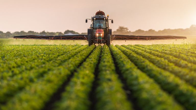
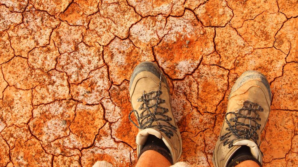
Assoc Prof Chand says it is also important to consider the differences between the onset of El Niño, the possibility of drought, and the different types of droughts. A meteorological drought generally refers to a long-term deficit of rainfall and persistent El Niño can lead to such a condition.
An agricultural or ecological drought relates to soil moisture, evapotranspiration and other factors, so if there has been higher-than-average rainfall in recent times, higher moisture levels mean that agriculture is less likely to be affected.
"El Niño doesn't necessarily mean agricultural or ecological drought will always happen. Conditions in preceding years can be a factor as well, and there has been a lot of rain over recent years, so there is moisture in the ground," he said.
"But El Niño can set the scene for a drought to potentially happen.
"Generally, there's a lag. If El Niño comes in and disappears by the following year, then conditions will return to normal. But if El Niño persists for two or three years, then drought is a real danger."
El Niño typically peaks during Australia's summer, having begun its onset three or four months earlier.
Assoc Prof Chand says the early warning signs mean Australia can better prepare for the potentially damaging consequences of a drying landscape.
"All of the rain that we have seen has given rise to the growth of fuel in areas that are prone to bushfires. That is why we have controlled burns – the fuel is already there, and if it gets dry and the weather elements are conducive to bushfires, the risk increases." Associate Professor Savin Chand
"For thousands of years, we have had these conditions – El Niño and La Niña – but how we mitigate their impacts is up to us. For instance, there is controlled burning for better control, but we have population growth in many places which are quite prone to bushfires. So there are various factors, not just climatic but only social factors.
"Anthropogenic global warming is another major factor contributing to extreme climate events over Australia."
"The cost of climate extremes and associated disasters, such as bushfires, drought and heatwaves, will increase as the global climate continues to warm in response to ongoing greenhouse gas emissions."
"Understanding the underlying mechanisms of hazards and how they may change as the climate continues to warm is essential if we are to improve Australia's disaster preparedness."
Related reading:
There's more to the wild weather than just La Niña
Floods, fires, drought – climate extremes to intensify without action: IPCC