New tool highlights our valuable urban wetlands
12 June 2024
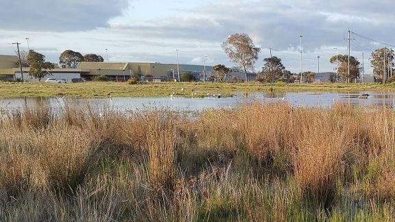
Urban wetlands are vital for supporting clean water, healthy ecosystems and bird migration but are often considered less valuable from an urban planning perspective in biodiversity conservation because they are highly modified or constructed bodies of water.
A Federation researcher has teamed up with the Atlas of Living Australia (ALA), the Australian Urban Research Infrastructure Network (AURIN) and BirdLife Australia to develop a new tool that aims to shed light on the often overlooked but essential role of urban wetlands in our cities.
The mapping tool, Valuing Urban Wetlands, integrates waterbird and landscape data to assess the health and importance of urban wetlands in the Greater Melbourne region.
The tool allows users to explore the world of urban wetlands. It provides individual waterbody reports on frog and waterbird species present at the site, as well as threatened species.
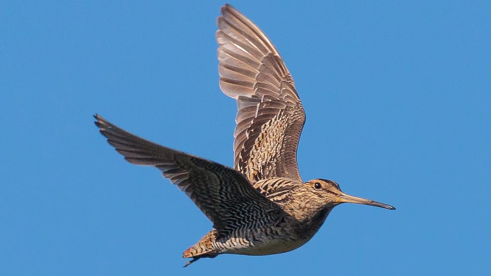
Centre for eResearch and Digital Innovation (CeRDI) Senior Research Fellow and project lead Dr Birgita Hansen says the project started with her work with the Latham's Snipe, a migratory shorebird heavily reliant on wetland habitats.
Latham's Snipe breeds in Japan and migrates to Australia for the non-breeding season. Research has revealed high numbers of snipe in some Victorian urban wetlands despite the bird being generally difficult to observe.
Dr Hansen has led citizen science efforts monitoring the snipe for several years and says the tool identifies the wetlands vital to the snipe and many other species.
"One of the aims of the Latham's Snipe project was to try and build more awareness in the public about wetlands in urban areas – you often have degraded looking swamps and marshes that people don't see any value in," Dr Hansen said.
 "But these wetlands provide important refuge habitat for various species in our cities, including the vulnerable Latham's Snipe. We developed this tool to help raise awareness of the biodiversity value of small urban wetlands by presenting snapshots of data recorded by citizen scientists."
Dr Hansen says partnering with AURIN, which focuses on built environments and urban infrastructure, and the ALA, which focuses on biodiversity and citizen science, allowed the research team to combine those elements.
The tool integrates waterbird and landscape data. Waterbird data collected through citizen science and professional science, including Birdlife Australia and eBird, is accessed via the ALA and overlayed with open landscape data to create metrics for assessing wetland health and importance.
"This was an opportunity to build a system around those two themes which are relevant to Latham's Snipe because we've got a species that occurs in wetlands in urban areas and we've got citizen scientists collecting the data," Dr Hansen said.
The mapped area is based on Melbourne Water's boundary and extends as far as the Yarra Ranges. Dr Hansen hopes to expand the tool to include Geelong and Ballarat in the future.
Dr Hansen says that by providing quantitative data on the value of urban wetlands, the project can inform better land use and development decision-making, which can lead to better protection of these crucial habitats.
Dr Hansen says an example of this is an abandoned industrial site on the outskirts of Ballarat that has supported nationally significant numbers of Latham's Snipe every year for the last four years. The land is currently being developed and the fate of displaced birds is uncertain.
"This is exactly the situation I am trying to capture with this tool – here is a wetland that a bird that is now listed as vulnerable under national legislation is using through our summer, but no one knows about it," Dr Hansen said.
"For many people, this is just a wasteland that will soon be covered by concrete.
"So the project is about trying to build that awareness in people. When you look at a water body in an urban area, it doesn't mean it's garbage, it might actually have significant biodiversity value."
To access the Valuing Urban Wetlands online portal, enter the wetland name or scroll across the map to zoom into an area and click on a wetland of interest to generate an area report. The report will list all frog and waterbird species in this wetland (based on the above data sources) and the number of threatened species.
Related reading: